


Contact Info
Float Camp Picnic Area
#4 Confederate Ridge Rd.
Doniphan, MO 63935
#4 Confederate Ridge Rd.
Doniphan, MO 63935
- Phone 1:
- 573-996-2153
Basics
- Number of Sites:
- 1
Amenities
Basic Amenities
- Drinking Water
Special Features
- Horseshoe Pit
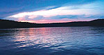
- Fishing
Details
Season
Open through Mon Sep 30 2013Location
Getting There:GPS Info. (Latitude, Longitude):
36.66472, -90.87139
36°39'53"N, 90°52'17"W
From Doniphan, Missouri, go 4.5 miles north on Highway Y. Go west on Forest Service Road 3210 for 0.5 miles to the recreation area.
Basic Info
- Total Sites:
- 1
Visitors enjoy horseshoe pits and volleyball courts, as well as hiking and other recreational opportunities nearby.

